Destination Detail Report
Machame Route Summit Program
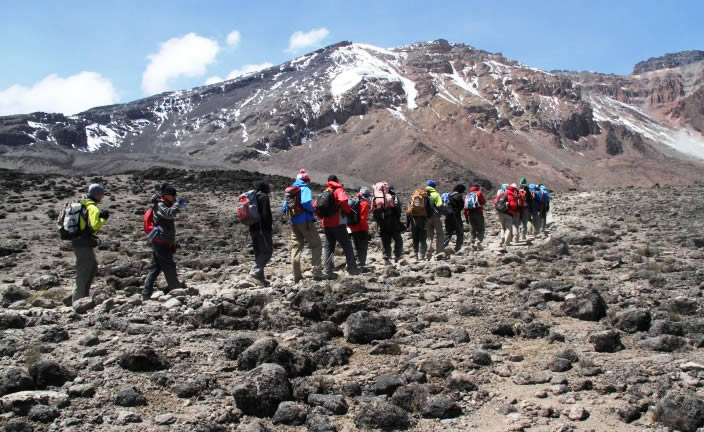
High-altitude summit journey with dramatic climate zones, demanding elevation gain, and strong safety-led expedition support. Machame Route Summit Program in Mount Kilimanjaro is ideal for travelers seeking clear structure and guided confidence.
Detailed Destination Table
| Category | Details |
|---|---|
| Climate | Variable alpine mountain climate. Warm lower slopes, cold summit zone, and possible night frost/wind above 4,000m. |
| Vegetation | Rainforest to moorland, alpine desert, then arctic summit terrain. |
| Location | Mount Kilimanjaro |
| Dangers | Altitude sickness risk, cold exposure, dehydration, and fatigue if pace is not controlled. |
| Altitude | Approx. 1,600m to 5,895m (Uhuru Peak) depending on route stage. |
| Safety | Daily health checks, acclimatization pacing, qualified mountain guides, and evacuation-ready protocols. |
| Program | 7 days · Mount Kilimanjaro |
Day-by-Day Route Table
| Day | Camp / Stage | Altitude | Vegetation Zone | Distance (km) | Daily Report |
|---|---|---|---|---|---|
| 1 | Machame Camp | 3,010m | Rainforest | 11 km | Steep forest trail with lush vegetation and first camp setup. |
| 2 | Shira Camp | 3,845m | Moorland | 5 km | Shorter but steep climb to moorland plateau and wide mountain vistas. |
| 3 | Barranco Camp | 3,960m | Alpine desert | 10 km | Lava Tower acclimatization point followed by descent to Barranco Valley. |
| 4 | Karanga Camp | 4,035m | Alpine desert | 5 km | Technical but manageable Barranco Wall day and acclimatization hike. |
| 5 | Barafu Camp | 4,640m | Alpine desert | 4 km | Summit preparation with hydration protocol and early sleep. |
| 6 | Mweka Camp | 3,080m | Heath to rainforest | 15 km | Summit day to Uhuru Peak then long descent to Mweka Camp. |
| 7 | Mweka Gate Exit | 1,640m | Rainforest | 10 km | Celebratory final descent, certificates, and hotel transfer. |
